Compass GEO (Google Earth Operations) is a web-based tool for rapid quoting of trucking rates to any destination from any company supply point, as well as a tool for competitive bidding and delivery optimization.
The main menu provides functionality to develop a zone grid system for tracking and billing deliveries, load driving times to each zone, from Google, and determine a haulage rate for each different type of truck.
The program then provides Google Earth overlays containing delivery zone and pricing information for use in house or on sales people’s laptops.
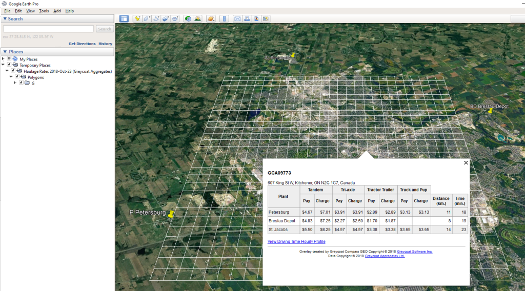
Rapid quotation of delivery price.
We don’t believe there is a faster way to quote delivery prices. Locate the delivery destination on the map by typing the address, click and view delivery charges from every supply location using every relevant truck type. There is also a driving time in minutes as a reality check.
Driving time profile.
Driving time can vary with time of day, and GEO provides a driving time profile.
Click on image to enlarge.
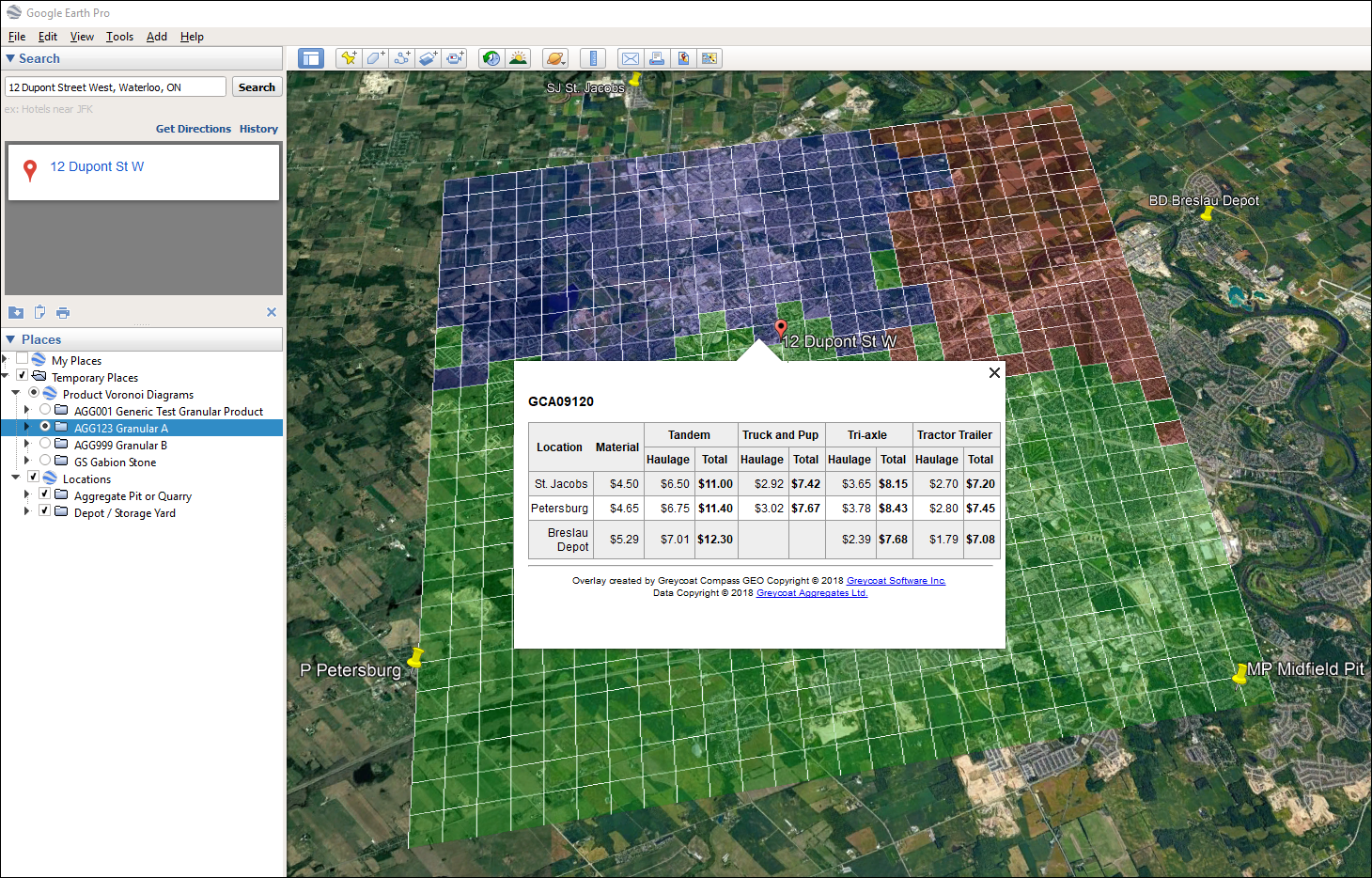
Delivery Cost Strategy
It may seem intuitive that the closest supply point is the ideal provider to a given job site, but this is not the case. The ideal supply point is the one which provides the lowest total cost including production and delivery elements. GEO will calculate the optimal service area for each product at each supply point, and show this with colour coded maps, as in the example above.
Competitive Cost Analysis
GEO also has the ability to calculate delivery costs from competitors’ supply points.
Click on image to enlarge.
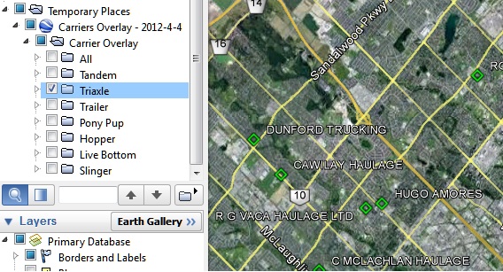
Other overlays.
GEO can provide other overlays, such as this one showing carriers.
Another useful overlay is active job sites, calculated in real time from the Compass SHIP and Invoicing programs.