The Land and Environment Management System (LEMS) is a web-based system designed to present a complete geographic inventory of a company’s land holdings, details on permits and licences for operations at those sites, and thorough information about those operations. LEMS is an advanced Geographic Information System and (GIS) and secure Content Management System (CMS) in a single easy to use product.
With LEMS a company can easily, securely, and reliably access, add, and modify detailed information about their land holdings including permitted land use, environmental plans and procedures, site licences and certifications, Indigenous consultation documents, and other pragmatic areas.
Basic Features
- Dynamic mapping of all sites and boundaries.
- Custom map overlays to visualise complex issues.
- Document Storage and Retrieval.
- Photo catalog for each site.
- SQL Database integration with reporting to an individually tailored dashboard created with Microsoft PowerPivot.
- Individual pages for each site.
- Create and track sub-objects for each site (site visits, site contacts, equipment).
- Strict security for user roles and data access across company divisions.
- Through-the-web access with mobile friendly output for instant access to company data from any location.
Short Video –
Features and benefits.
Click on image to enlarge.
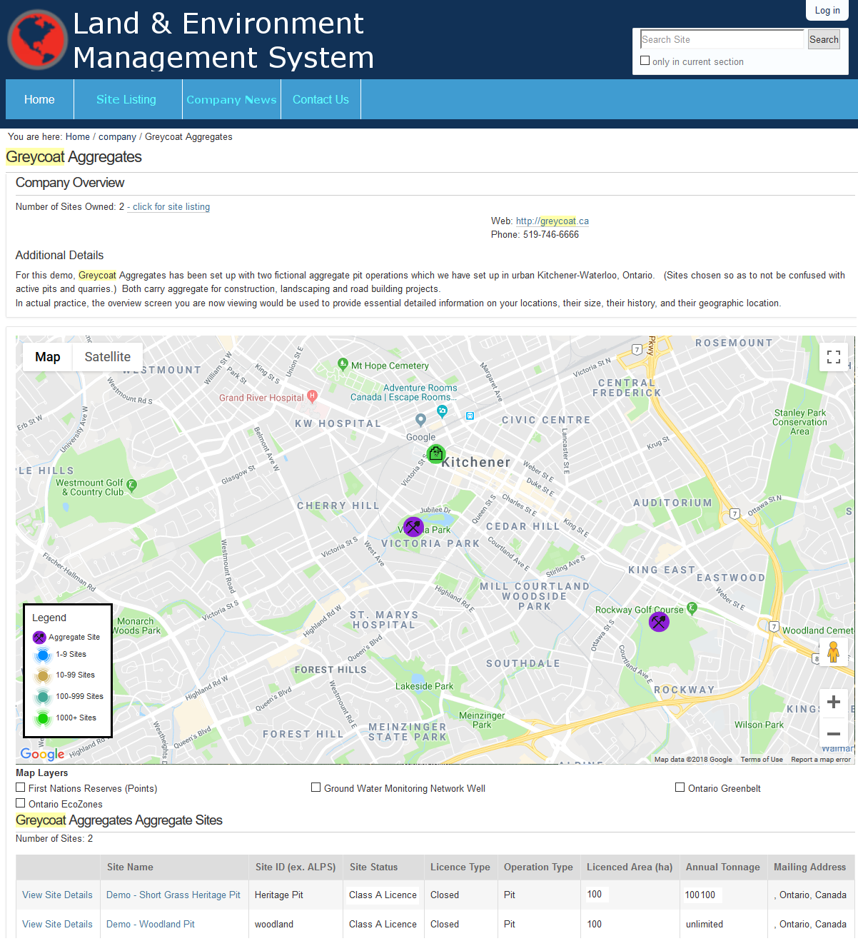
Company summary page.
On the LEMS homepage, basic company details are presented along with a map of all company locations, and a table with all sites listed. Authorized users may change company information, add new sites, and access existing sites from the home page.
After logging-in, a user with adequate security permissions may edit a page, add new items, or change the status of the page through the “action bar” at the top of each page.
All company sites are both mapped and listed in a sortable table with a link to their individual pages, and a quick overview of site details.
Click on image to enlarge.
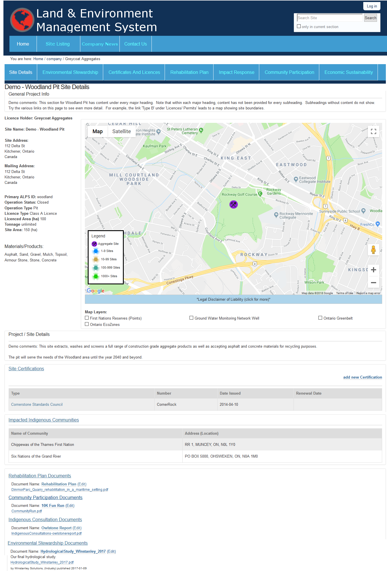
Site details page.
To access full information on individual sites, select the site from the map or site table on the company home page, or use the fully indexed search bar.
Click on image to enlarge.
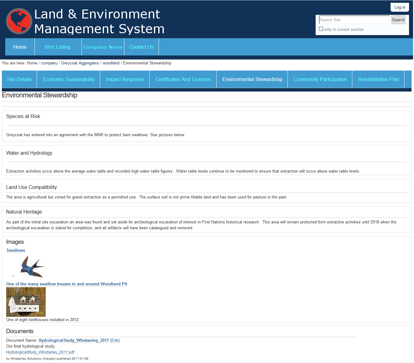
Key Area of Focus – Environmental Stewardship.
Within each site you can review and modify site details and access any of the seven additional “key areas “for data entry from the site tab bar:
- Environmental Stewardship,
- Certificates and Licences,
- Economic Sustainability,
- Rehabilitation Plan,
- Impact Response,
- Indigenous Consultation,
- and Community Participation.
Any of the key areas can be excluded or added at any point, and custom sections can be included as requested.
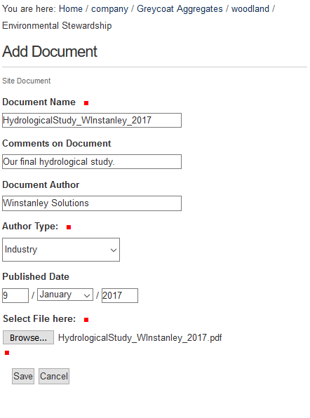
Click on image to enlarge.
Add documents to the site repository.
Types of documents to be loaded include: licences, certifications, permits, annual reviews and others.
Quickly add important documents to the key areas, and review all site documents on the site page.
An adaptive folder hierarchy means documents, images, and data stored in LEMS will be organised in a way that makes sense to each company, and facilitates simple access.
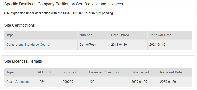
Click on image to enlarge.
Track key licence and certification elements.
Keep track of site licences, permits, special certifications (ISO, CSA, etc), along with significant dates.